Topographic Survey | Topo Survey
What Is a Topographic Survey?
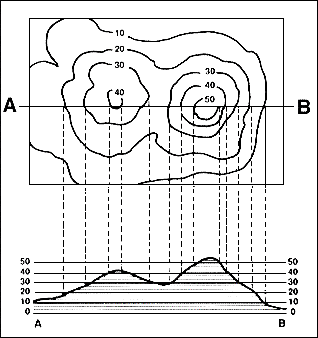
A Topographic Survey, often called a Topo Survey, maps both natural and man-made features on a parcel of land, including surface contours, buildings, utilities, and elevation changes. Think of it as viewing your property from above—but with precise elevation data.
Unlike typical boundary surveys, a topo survey captures land elevation using contour lines and spot elevations to represent the surface of the land in 3D.
Why You Need a Topographic Survey
Whether you’re developing a property or preparing a site for new construction, a topographic survey provides the critical starting point for engineers, architects, and contractors.
Topographic surveys are essential for:
Engineering site designs and grading plans
Earthwork calculations (cut and fill balancing)
Drainage planning and environmental studies
Visualizing site limitations such as steep slopes or existing structures
Design without surprises. Build with confidence.
📋 Book your pre-construction survey and ensure your design fits the land—not the other way around.
Our Process
Accurate. Thorough. Reliable.
We combine modern surveying technology with decades of experience to deliver detailed and accurate results.
Here’s how we do it:
Deed Research: In-depth examination of your deed and those of neighboring properties.
Monument Location: Locating or setting corner markers (pipes, rebar, posts, etc.).
Field Traverse: Measuring distances and angles to confirm or correct property lines.
Drawing & Documentation: A professionally prepared survey drawing with legal descriptions and boundary details.
Advisory Support: Floodplain assessments, subdivision guidance, and resolution of encroachments.

How We Conduct a Topo Survey
Conventional Topo Surveys
Performed on foot using total stations or survey-grade GPS. Ideal for high-precision projects like:
Utility placement
Sewer and drainage design
Sites with steep slopes or complex features
Aerial Topo Surveys
Executed with overlapping aerial photography to build a 3D surface model. Best for:
Large-scale mapping
Planning over wide terrain
Moderate contour accuracy (1–5 ft. intervals)
BLOgs & NEWS
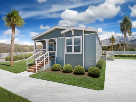
Tiny homes are not just a trend, they’re a movement… when done right!
From cost-conscious first-time buyers to minimalists seeking simpler living, the demand for compact, efficient housing has exploded across the U.S. And Al ...
Skipping Phase 1 and Phase 2 Engineering? Here’s Why That Could Be a Six-Figure Mistake in Alabama
You’ve got land in Alabama and a vision—maybe a residential subdivision, a commercial build, or a mixed-use project that could transform a corner of your count ...
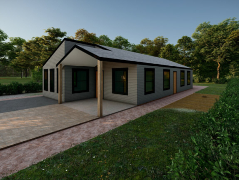
Tiny Homes, Big Headaches: The Regulatory Roadblocks Killing Small-Scale Projects in Alabama
Tiny homes are not just a trend—they’re a movement. From cost-conscious first-time buyers to minimalists seeking simpler living, the demand for compact, eff ...
What’s Actually Allowed On Your Alabama Land? Zoning May Say Otherwise
You bought land. It’s yours. So naturally, you can do what you want with it, build a few homes, maybe a shop, or even that tiny home village you’ve been dreami ...


